

Study area and background
In NSW, local government is responsible for managing flood prone land by following the process in the NSW Flood Prone Land Policy. This aims to reduce the impacts of flooding and flood liability on communities, reduce the private and public losses resulting from floods and increase community resilience to floods.
The process has four steps:
- Data collection
- Flood study
- Flood risk management study
- Flood risk management plan.
Council worked with consultant WMAwater to prepare a the North Creek Flood Study (adopted by Council in March 2025), which completed the first and second steps of the process.
We then continued to work with WMAwater to deliver the Flood Risk Management Study and Plan (adopted by Council in February 2026), the third and fourth steps of above process.
In Lake Macquarie City, there are 10 major catchments feeding into the lake and Council has adopted flood studies and flood risk management plans for all of the major catchments and most of the minor catchments.
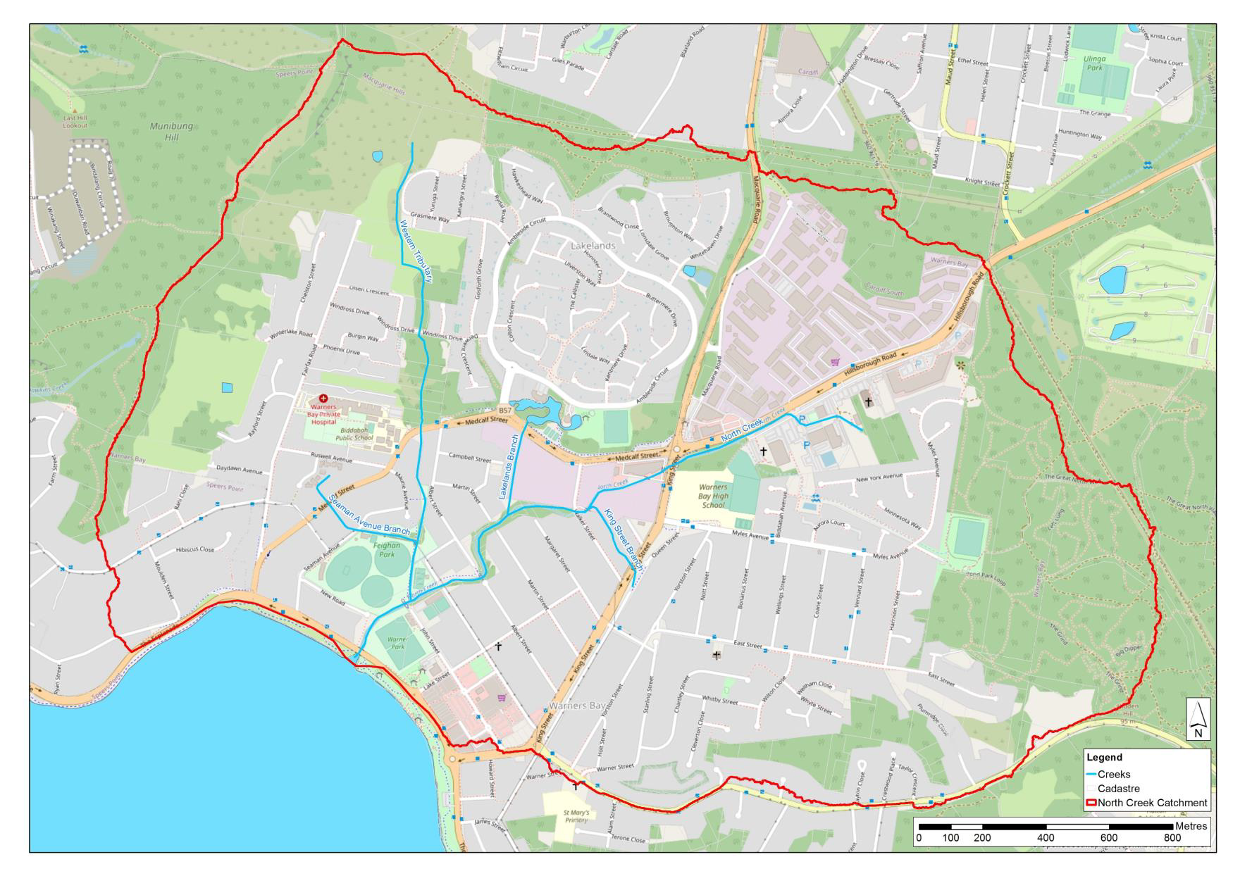
Map of the study area

